The Seaside Revolution
Seaside represents a major landmark in American urban design.
It might seem odd that a beachfront community should inaugurate a major urban planning movement. But as many readers of The American Conservative know, that is what happened with Seaside, the eighty-acre Florida panhandle resort whose design four decades ago launched what would become known as the New Urbanism.
Between the 1930s and ’50s, the historic pattern of American urbanization was overthrown by urban renewal within our cities and suburban sprawl outside them. These juggernauts were driven by modernist separation-of-uses dogma. Especially in the suburbs, such dogma served to spatially disaggregate Americans’ daily destinations for living, working, schooling, shopping, and worshiping while canceling the pedestrian scale of the built environment along with architecture’s traditional streetscape-shaping function. Streets, avenues, and boulevards became lanes, collectors, and arterials serving as automobile conduits exclusively.
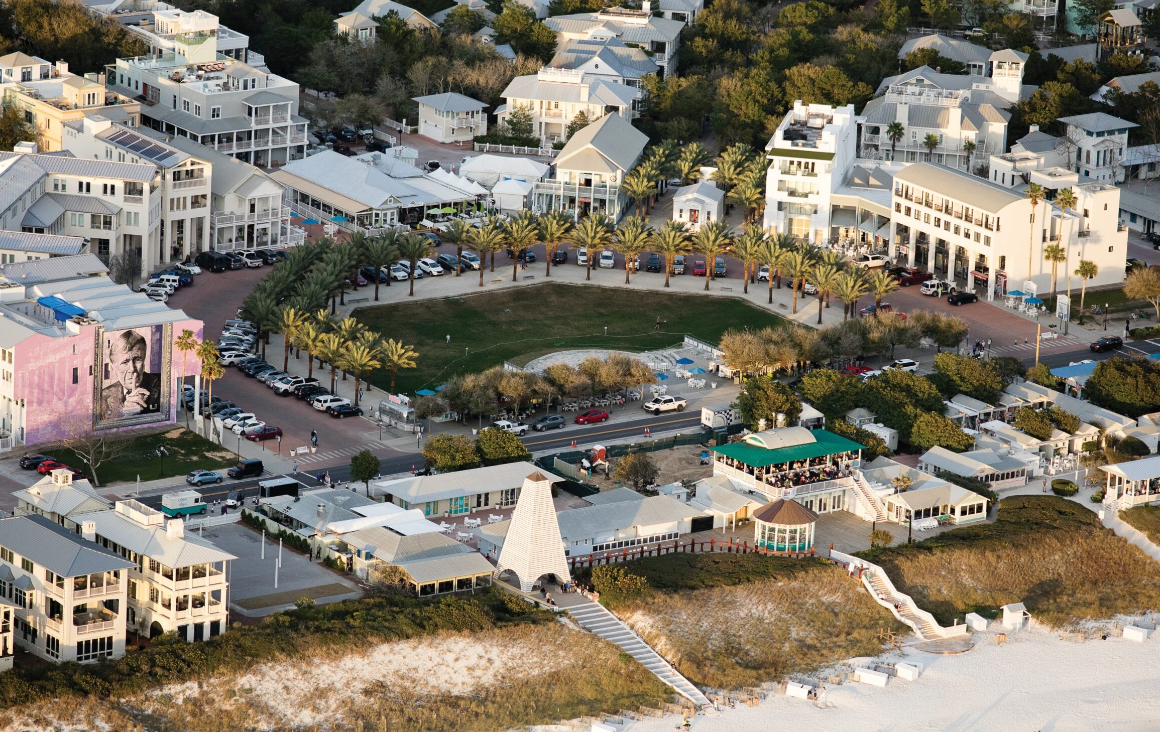
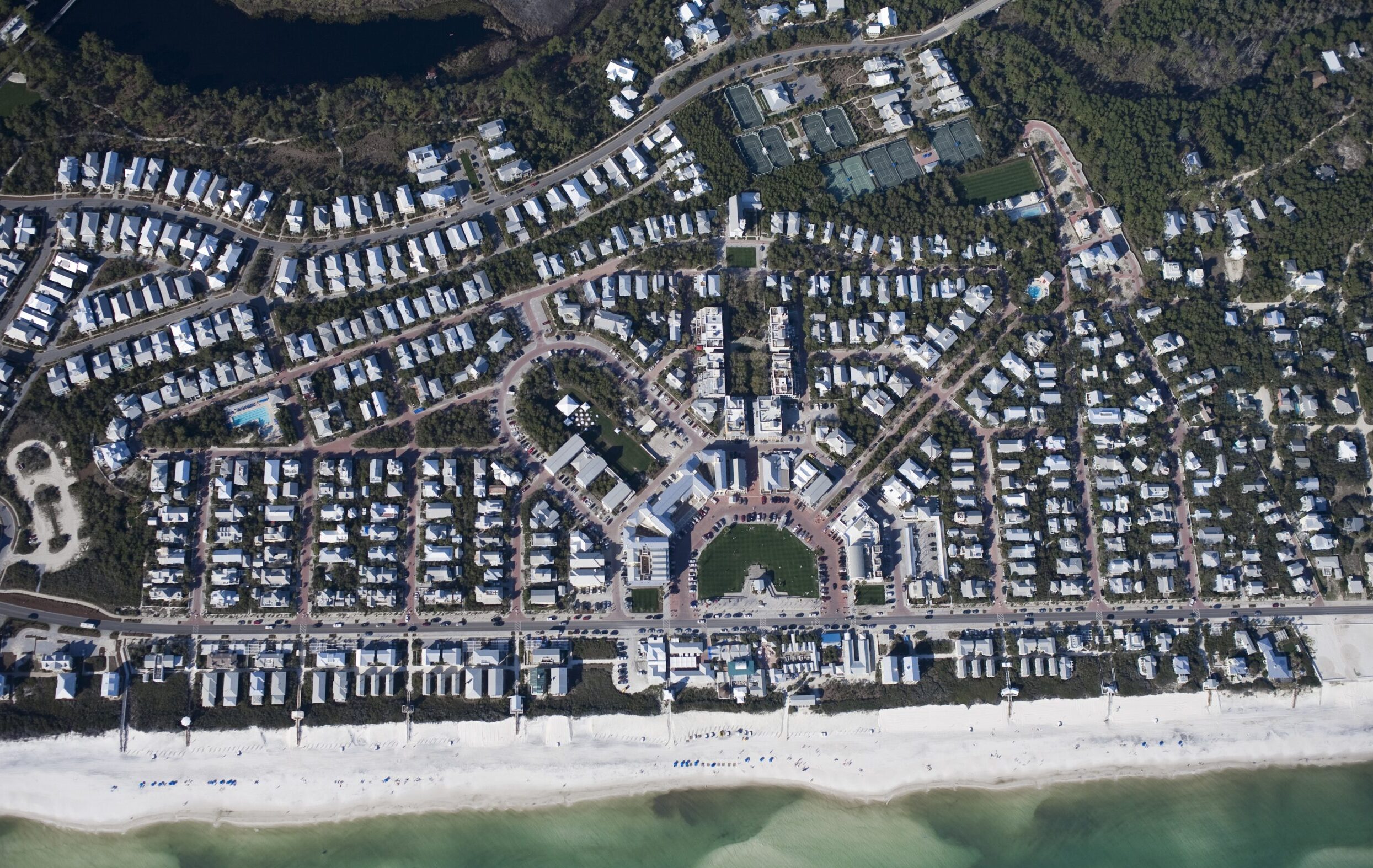
The gridiron plan was the urban template that Modernism overthrew. Its origins extend back to remote antiquity. It can be deployed mechanically or imaginatively. Seaside reinstated it, imaginatively. Celebrated for pastel-colored cottages—ranging in style from stately to funky—along with porches and white picket fences, Seaside is equally notable for its intricately modulated grid, which accommodates the geometrically irregular parcel of land on which it is situated. Seaside mainly lies north of a county road, 30A, running along the Gulf of Mexico. Its network of streets radiates from a spacious town center abutting the county road. The center’s geometrically precise, five-sided layout is modeled on, and duplicates the scale of, Siena’s much more irregular, roughly fan-shaped Piazza del Campo.
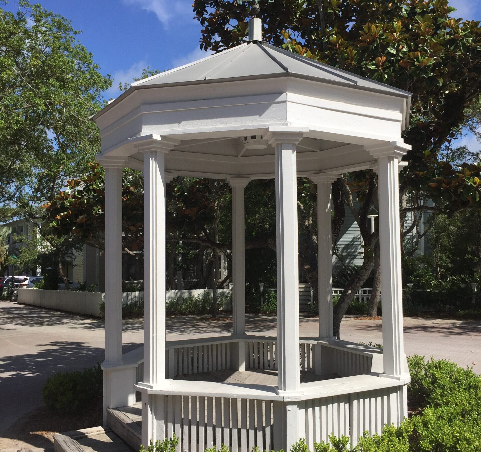
Seaside features streets that run straight for a block or two but then deflect, inducing a sense of spatial continuity. Axial vistas, on the other hand, are terminated—in one case, by a church lying at the end of the central axis extending from the town center; in another, by a gazebo. Seaside thus combines dimensional and pictorial values I described in a previous commentary, “Siena’s Medieval Cityscape.” Pictorial values in urbanism are typified by linear axes (streets, avenues, or malls) terminated by institutional buildings or monuments. Dimensional values are evident in streets that curve or otherwise deflect so as to suggest uninterrupted spatial flow. The latter values are experienced on old Siena’s narrow, winding streets.
OK, a gazebo is not a monument. But the gazebo on Seaside’s Tupelo Street serves as an axial terminus (while also marking the street’s deflection point). And here’s the thing about Seaside: its designers, Andres Duany and Elizabeth Plater-Zyberk, whose office is known as DPZ, displayed a fledgling awareness in designing Seaside that the gridiron town and even the high-end classical city with its avenues radiating from key institutional nodes (like the Capitol and White House in Washington) were geared to pictorial values—and they incorporated such values into their plan. But how did they become aware of urbanism’s dimensional aspect, which is also in play at Seaside? They observed it in visiting medieval towns like Siena, to be sure, but they were also informed by the writing of a 19th-century Austrian architect and theorist, Camillo Sitte, and two scholars who brought Sitte’s ideas to the attention of an American audience, Werner Hegemann and Elbert Peets, authors of a classic urban-planning primer, The American Vitruvius, that was originally published in 1922.
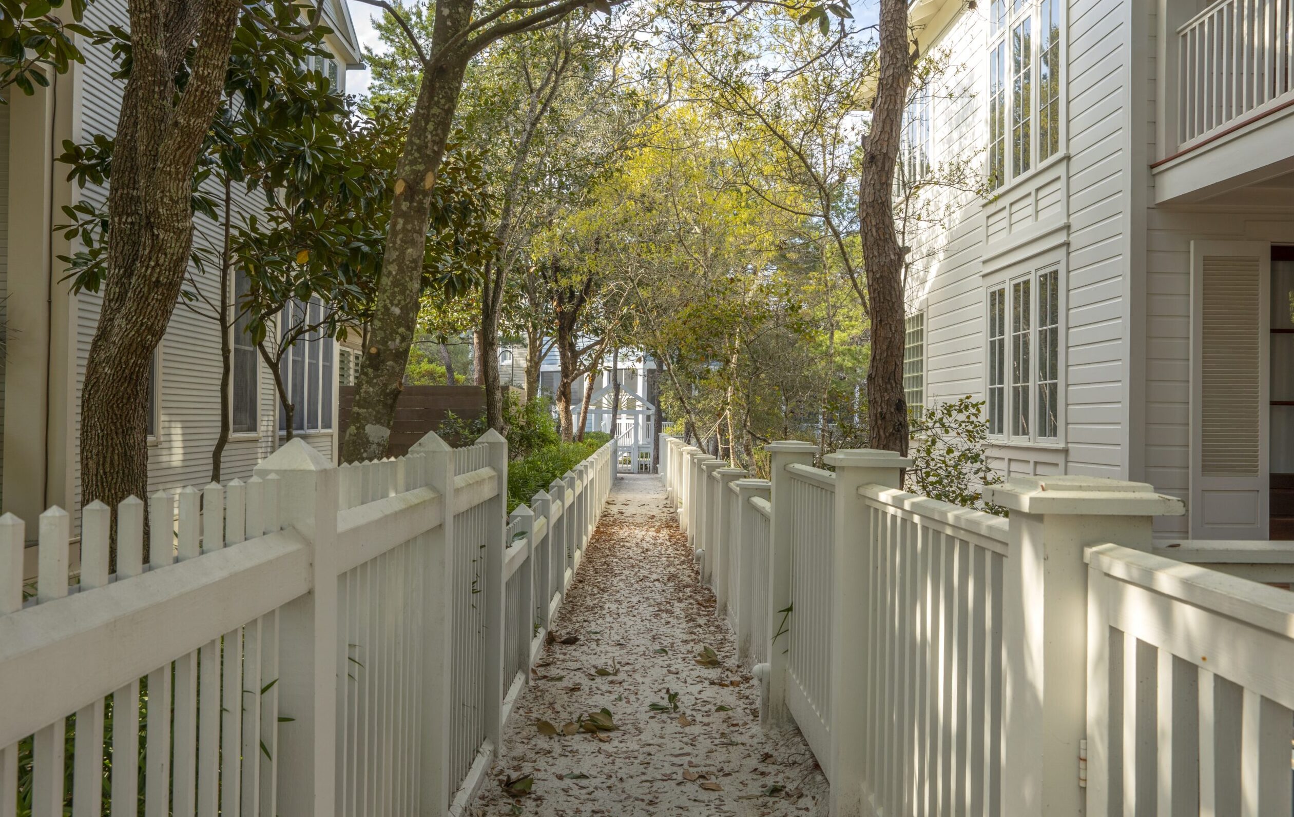
The dimensional impulse runs deep in Seaside’s layout, and it is not just a matter of the platting of streets. It is evident too in the network of pedestrian paths—just five feet wide, lined by the familiar picket fences and strewn with white sand—dubbed Krier Walks in honor of the architect and planner who suggested them, Leon Krier. These paths run between Seaside’s cottages, allowing you to see them in the round instead of being limited to frontal, pictorial vistas from the street. Your experience of the place becomes more omnidirectional, more dimensional, when you wander along these paths. They are also wonderful exploration routes for children.
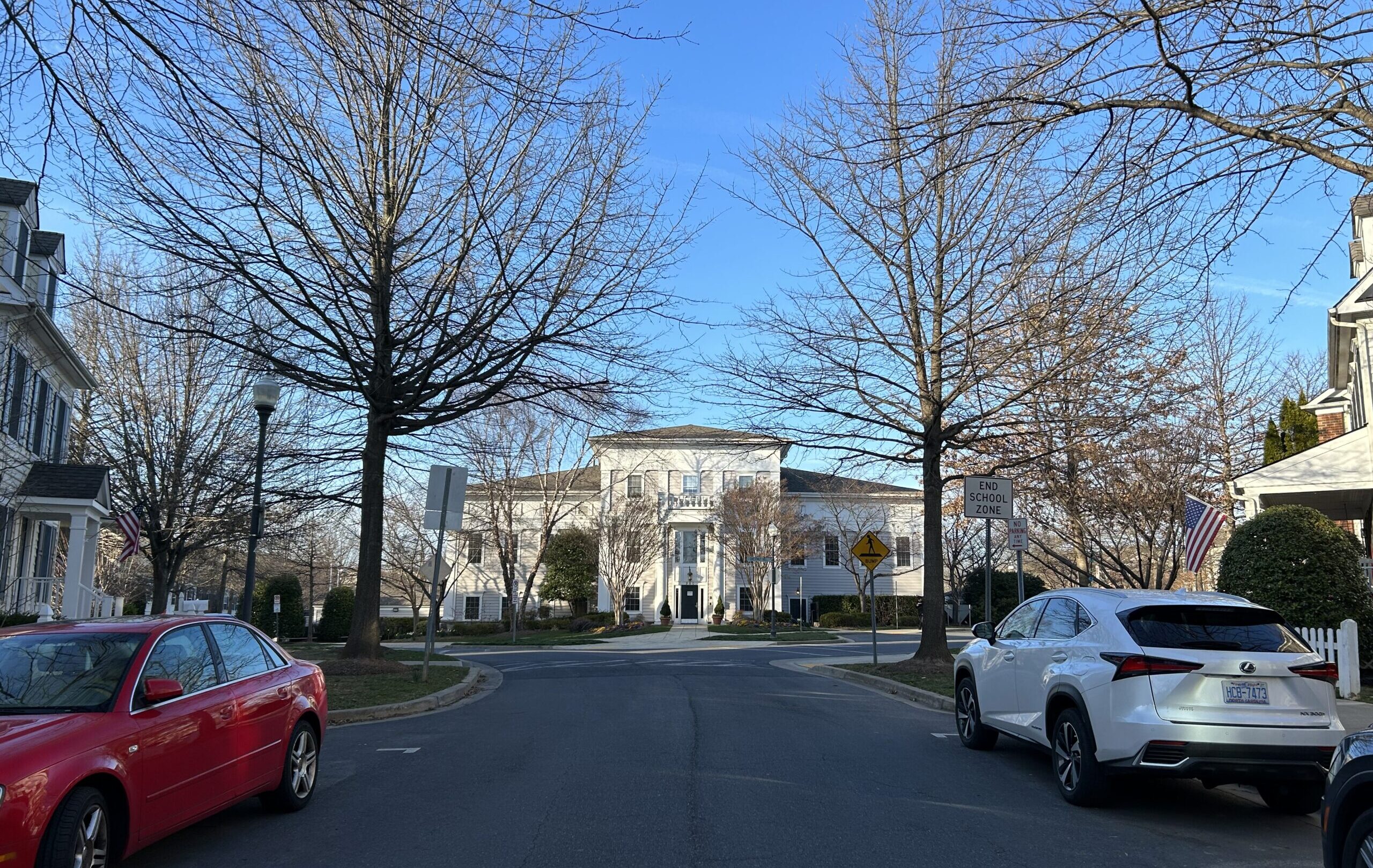
The dimensional impulse can also be observed at another of DPZ’s more important projects, Kentlands-Lakelands in Montgomery County, Maryland. These are, strictly speaking, separate, contiguous developments, but they might easily be taken for a single community. DPZ planned Kentlands in 1988, while Lakelands was laid out during the following decade. Together they extend over some 700 acres, include a shopping-dining-entertainment district (which remains a work in progress), two schools, a church and a synagogue, and are home to about 10,000 people. Unlike Seaside, the terrain here includes lakes, wetlands, hills, and dales. The single-family homes, townhouses and multifamily abodes at Lakelands were erected by production builders who, unlike homebuilders at Kentlands, were permitted to use vinyl siding and asphalt roof shingles. Kentlands-Lakelands architecture is more consistently traditional than Seaside’s. The quality is uneven—this is not a luxe resort like Seaside—but good enough to create an exceptionally welcoming environment.
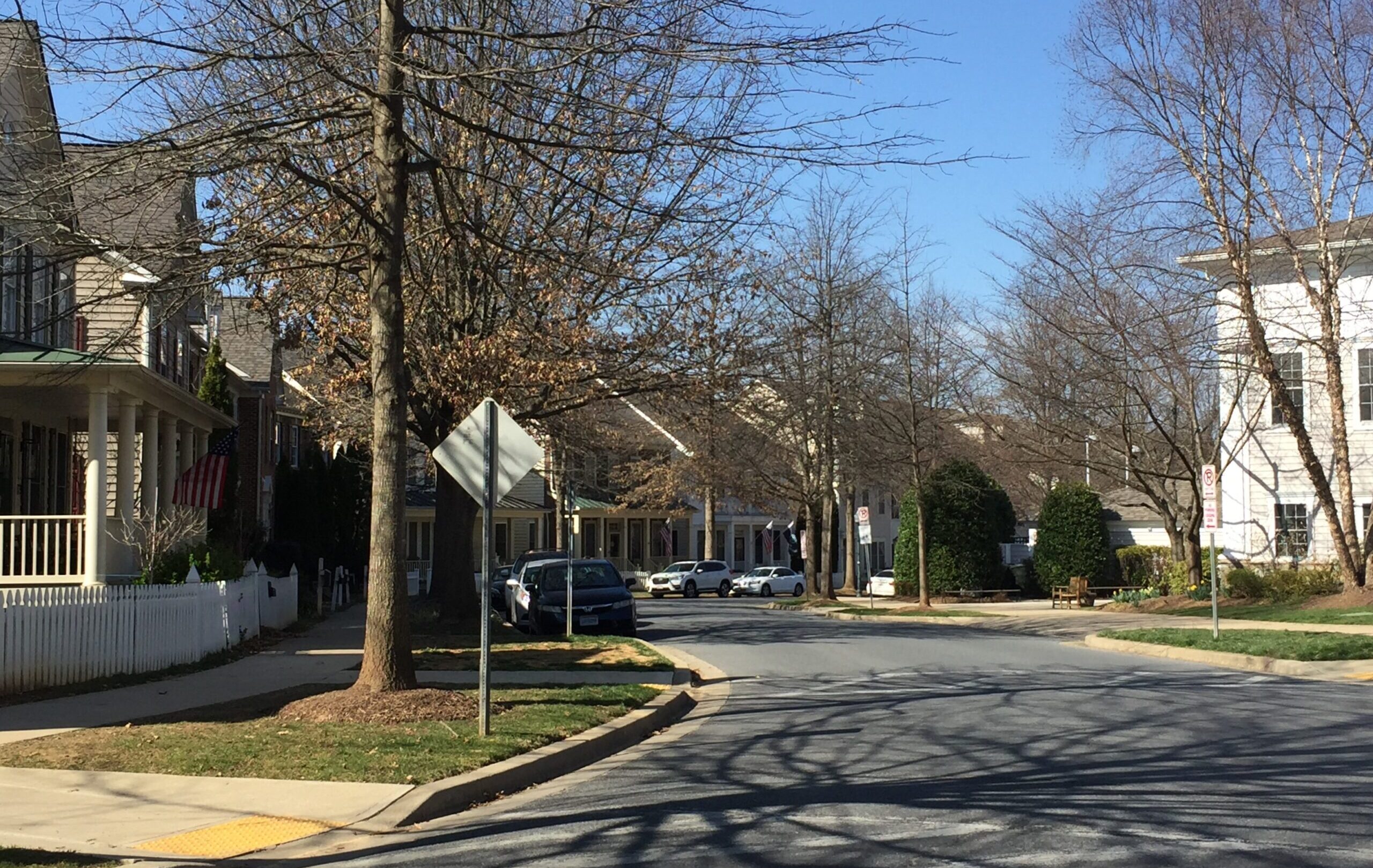
Siena’s streetscape entails conformance to the natural topography. Kentlands and Lakelands follow suit to a notable degree, with numerous street sightlines leading you around the bend. The residents’ clubhouse at Lakelands is a clapboarded manse with a central entrance portico that terminates a two-block stretch of a Main Street running through both communities. The street forks in front of the clubhouse, with Main Street and its single-family homes bending around it on a gently descending trajectory on one side, and another street doing the same on a level trajectory on the other.
The resulting streetscape seems to embrace the club building on each side. This is a decidedly dimensional touch, and though it might seem commonplace, it is anything but. In postwar suburban development, civic buildings don’t get framed this way, and topographical irregularities get leveled to make way for serpentine lanes that make little sense in their absence, and where houses are set too far back to play a space-shaping role.
Duany and Plater-Zyberk were on a learning curve when they designed Seaside. Their town center emulates Siena’s Piazza del Campo in plan only. It does not emulate it in three dimensions. The low-key, mainly medieval architecture framing the piazza is much more consistent in formal terms, much more consistent in its greater height, and much less porous than the Seaside town center’s rather disjointed and generally disappointing architectural frame. As a result, my first visit to the piazza last summer, which followed my first visit to Seaside by a year, induced no sense of deja vu whatsoever. One important and unavoidable difference between the two spaces is that the piazza was laid out on a tilted gradient.
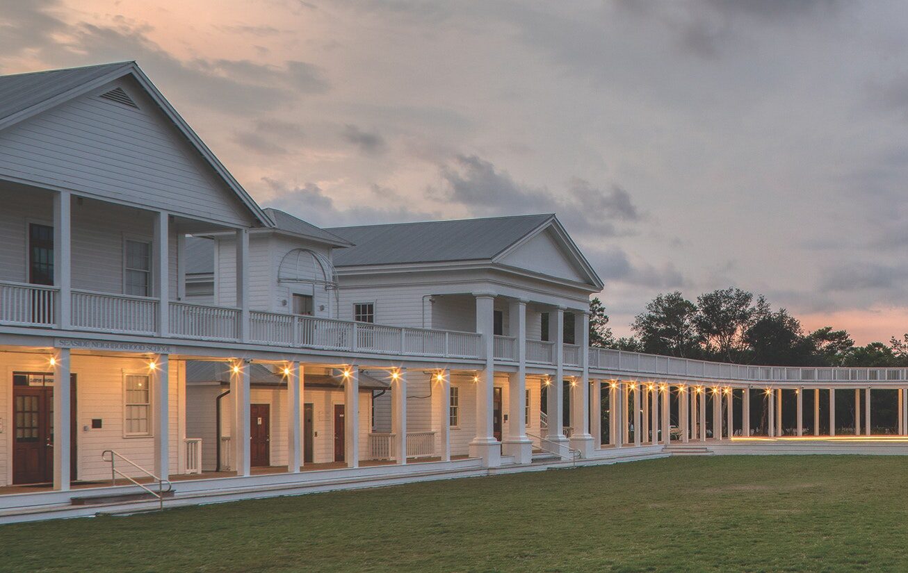
Still, the spatial diversity one experiences at Seaside—ranging from sideyards, parklets and bosques to elegant Seaside Avenue with its lushly landscaped median—makes a strong impression, as does the low-maintenance xeriscape of regionally themed plantings. Architect-planner Dhiru Thadani’s Lyceum, completed in 2017, contributed another distinctive outdoor space. Here a colonnade supporting an elevated promenade connects Seaside’s three charter school buildings on one side of a lawn with an auditorium on the other—all four being simple pre-existing wooden structures painted white, all now connected by Thadani’s colonnade on two levels. The colonnade loops around an open-air, wood-planked stage at one end of the lawn. Jefferson’s Lawn at the University of Virginia provided inspiration for Thadani’s design. His Lyceum—intended to eventually link three more buildings—extends from the town center on a diagonal, echoing Seaside Avenue’s radial trajectory. It enriches the resort’s idiosyncratic spatial mix.
Subscribe Today
Get daily emails in your inbox
(For the record, Thadani is Seaside's foremost chronicler, having edited two weighty, generously illustrated tomes devoted to the place, Visions of Seaside, 2013, and Reflections on Seaside, 2021.)
The town center, which includes a grassy amphitheater at its core as well as shops, restaurants, apartments, a grocery store and a beautiful little post office, has been fabulously successful. Yet its architectural frame, a truncated horseshoe in plan, remains incomplete at the extremities adjacent to 30A. And it is doubtful the dramatic landmark designed to rise between the amphitheater and 30A will ever be built. This is Krier’s proposed free-standing variation on the Piazza del Campo’s soaring Torre del Mangia (1348), which rises from the Palazzo Pubblico at the plaza’s bottom.
Even so, Seaside itself represents a major landmark in American urban design.