A History of Sprawl in One Road Trip
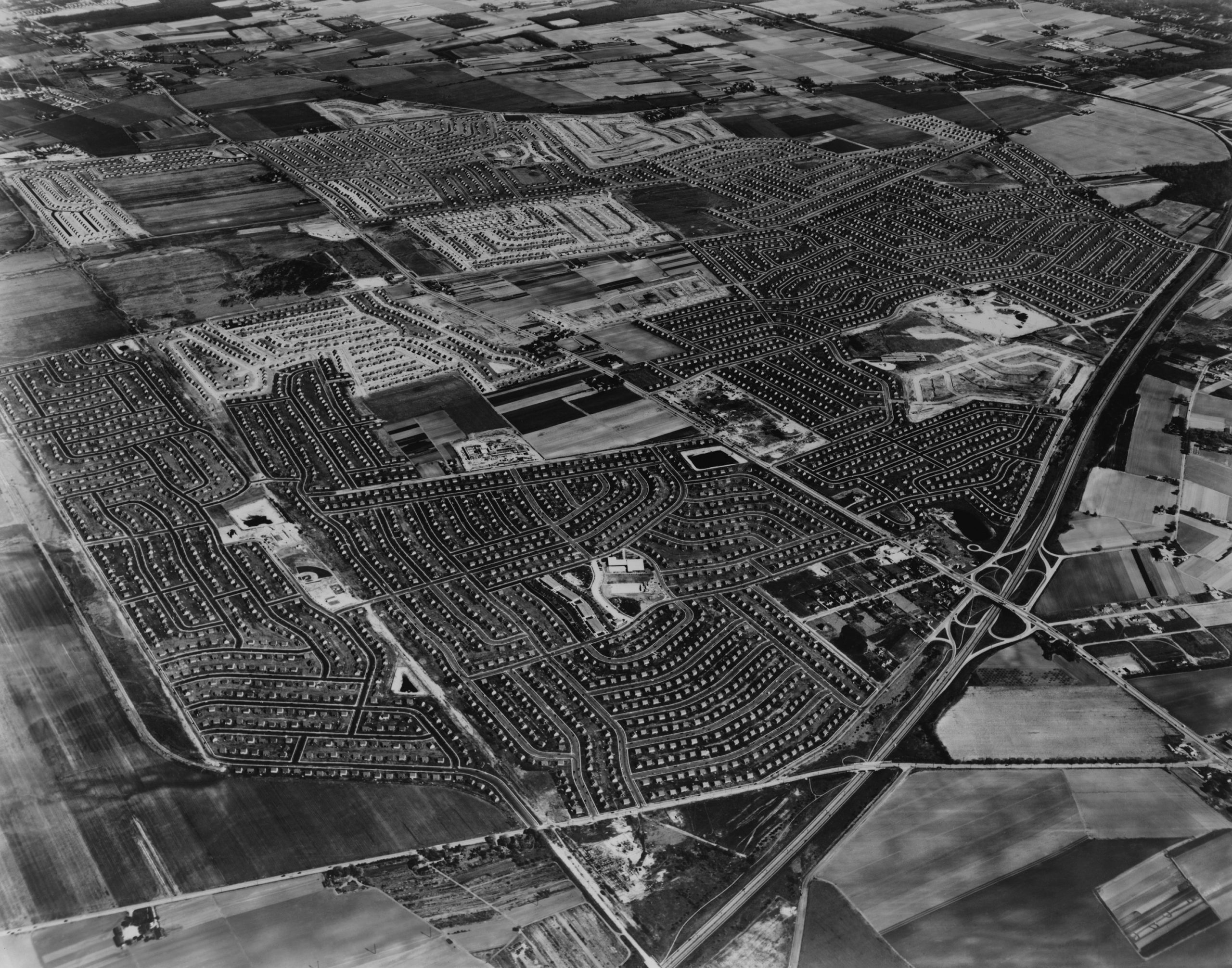
Suburban sprawl is like pornography: we know it when we see it, and it’s everywhere. There’s no single definition, or more accurately, there are many. Perusing the quite thorough Wikipedia page for “urban sprawl” gives you an idea of how complicated a phenomenon it can be. The Census, for its part, doesn’t even measure or define “suburban,” despite the fact that most of the country lives in places somewhere between urban and rural. Certainly, you can learn a lot about our patterns of development by reading and using historical imagery (like NETR Online’s excellent Historic Aerials service).
But while the etiology of sprawl is observable over time—those aerial photos over the years reveal farms turning into subdivisions and country roads into six-lane highways—it is also observable over space. You can study the history of development patterns, but you can also hop in a car and drive down one of the highways along which sprawl has proliferated and, further and further out, is often still proliferating. Consider for a moment what this means: driving away from the city is like going back in time.
To illustrate this curious insight, I grabbed a camera and drove down the Virginia stretch of U.S. Route 50, the main pre-Interstate access road into D.C. and as good an example of typical sprawl as you’ll find anywhere. Closer into D.C., in Arlington and Fairfax, a good deal of the early post-war construction still remains, making for some retro sightseeing along the way.

Unlike in previous pieces, however, I did not focus only on the densely built commercial and retail segments of the highway (which are interesting phenomena in their own right). I drove all the way out from D.C. to Winchester, Virginia—the closest thing to a city going west for hundreds of miles, and a long-established community well outside of the D.C. suburbs. The whole route is about 70 miles and two hours (with light traffic), and it takes you through every built environment you can imagine. Call it a history of sprawl in one road trip.
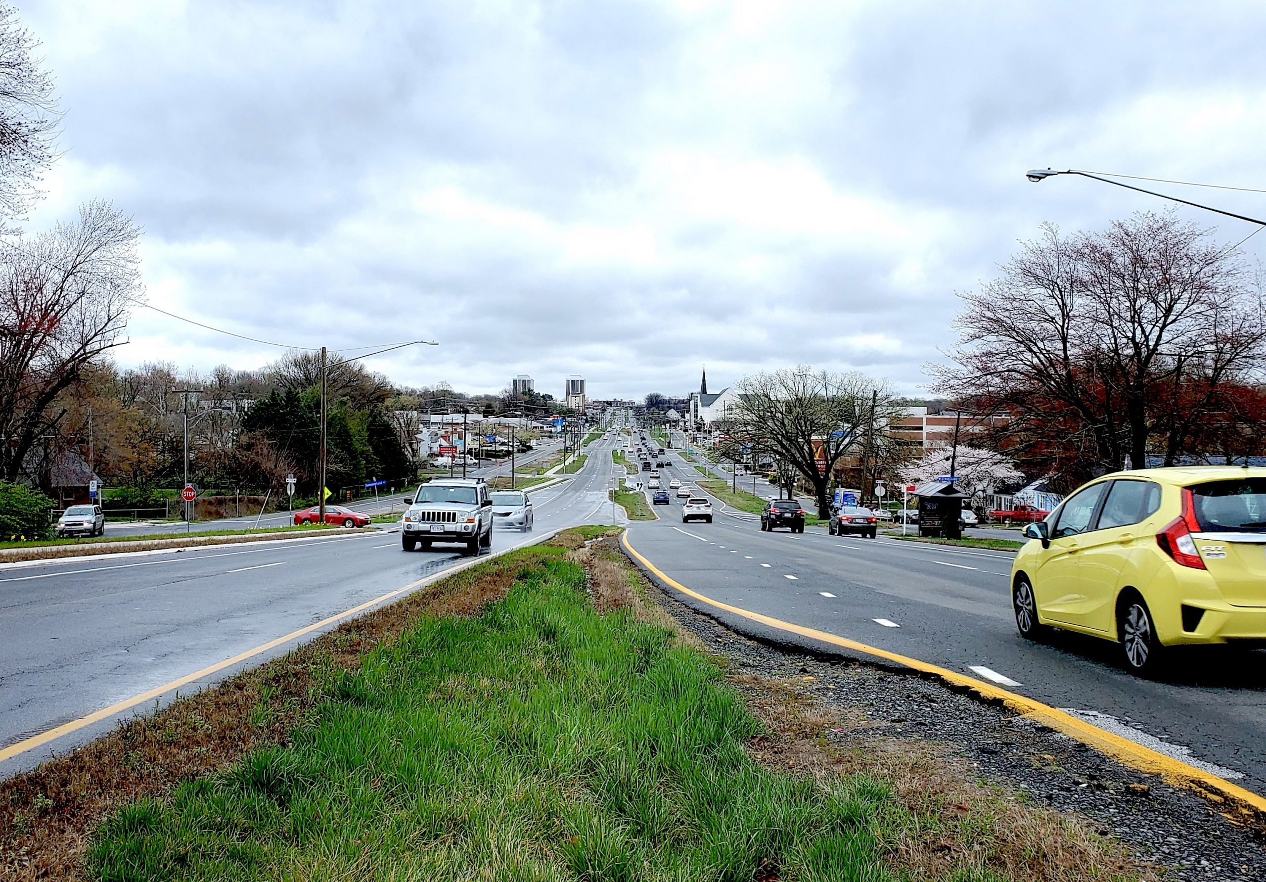
It starts across the river from D.C. on Arlington Boulevard, the local name for U.S. 50. For a couple of miles, the surroundings are almost indistinguishable from parts of D.C. itself; Arlington’s nearby Ballston-Clarendon-Rosslyn corridor, substantially low-rise and auto-dependent before the 1980s, is one of the most dramatic examples of densification in the region. But it doesn’t take long for this to devolve into a long and more or less unbroken stretch of low-rise sprawl; massive strip plazas, dangerous interchanges, housing developments, scattered fast-food joints, car dealers, and occasional stretches of houses, woods, or older office towers.

Not counting its service roads, U.S. 50 is six lanes wide through much of this, and four at a minimum. It is utterly inhospitable to pedestrians, and barely hospitable to motorists. A couple of mixed-use developments along the way, little islands in a sea of speeding cars, are only one more element in the discordant list of elements that’s the secret sauce of sprawl. Oh, and Seven Corners, which feels like it consists of the atom-smashing of seven highways and seven shopping centers.

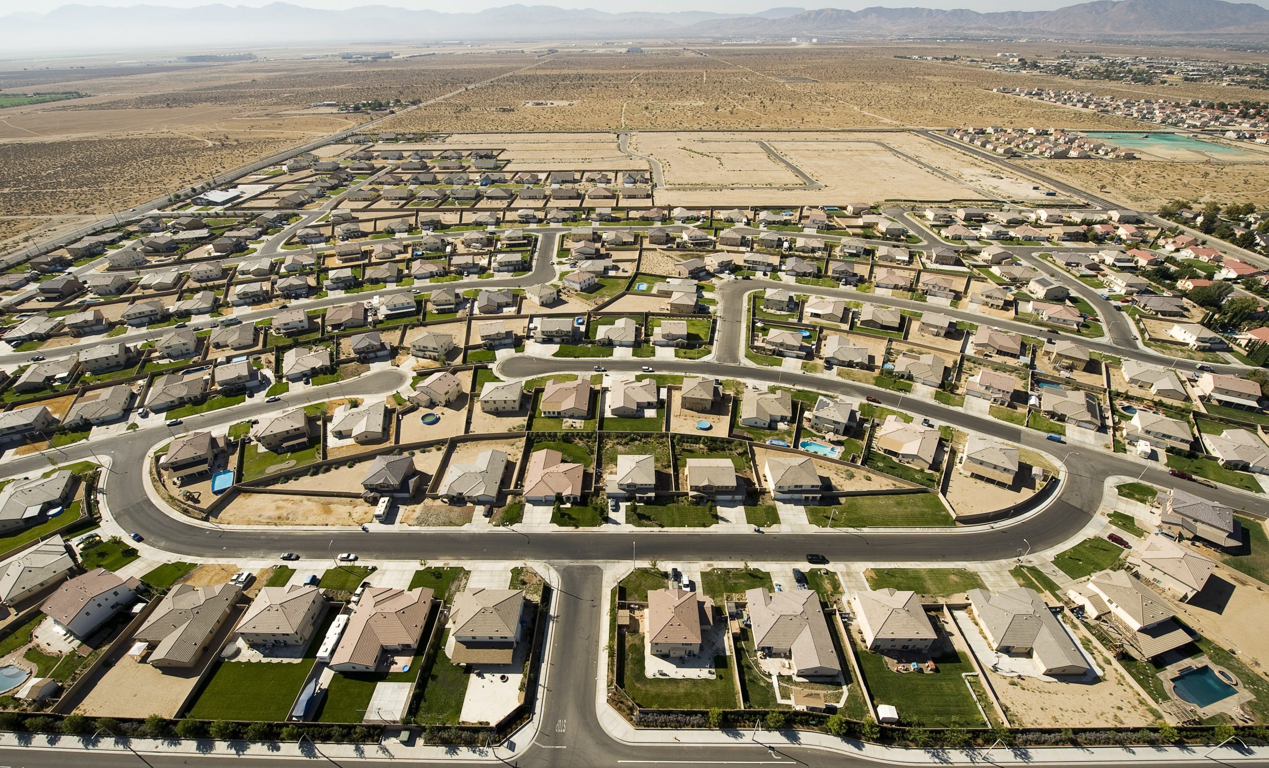
About 20 miles later, with little change in the appearance of the road or roadside, I got to Chantilly. You wouldn’t know from looking, but Chantilly is the last major agglomeration of sprawl-style development. The density gradient has been decreasing slowly—a little more distance between the strip malls—but now it’s about to decrease dramatically as I pass through a “transition zone”: a thin band of genuine countryside that is currently undergoing suburbanization.

Chantilly itself only suburbanized in the 1980s; before that it looked pretty much like the open space a few more miles out. The older, denser suburban development in Arlington and Fairfax was itself much lighter between 50 and 70 years ago, depending on the exact area: basically similar to what we now call exurban. The exurbs, in a sense, are not a new invention; they are simply pushing further and further out. In other words, if you want to see something like Arlington’s early days, drive west to that transition zone.
We are really seeing two things here: a physical history of the layers/rings of development, and the current built form/stage of development of each particular place. Places back east like Annandale or Bailey’s Crossroads, or some parts of Arlington—now congested and undergoing some of the physical decay typical of early suburbs—were not built all at once. They all went through a process: something like countryside/farm > transition zone > exurb > suburb. Unless land use and housing affordability change dramatically, in all likelihood today’s transition zone, and communities still further west for 10 or 20 miles, will eventually go through this same process. At the same time, the overall density gradient or layers of development, driving west from D.C., will remain observable, because there will always be a particular land area undergoing transition.
Keep your eyes open through this brief transitional stretch, where decrepit farmhouses surrounded by bulldozers stand side-by-side with massive new car dealers and supermarkets. You’re about to see a recently built strip mall, at just about the 30-mile mark from the edge of D.C. This is the last strip mall until Winchester—another 40 miles away!

At this point, if you’ve managed to somehow avoid any traffic, you’ve only been driving for 45 minutes, and the seemingly infinite D.C. sprawl has abruptly evaporated. It occurred to me, as U.S. 50 narrows down yet speeds up, that the apparent extent of Northern Virginia suburbia is greatly magnified by its congestion, which increases the perception of distance. The longer half of the trip is breezy and pleasant, a taste of what it must have been like to be an early adopter of the automobile.
An array of new housing developments, starting at prices well above the national average, quickly give way to an actual main street, in Aldie. U.S. 50 narrows down to just two lanes. The next main street, in the 18th-century town of Middleburg, is a wealth of historic architecture, some of which rivals Old Town Alexandria. Middleburg’s freestanding Safeway is just about the only chain establishment for these 40 miles before Winchester. It’s built to look historic, and its truck bay is in the front, allowing the building to back right onto a sidewalk. It’s a rare, human-scaled big-box store. Of course, Middleburg predates U.S. Route 50; this stretch was an old trade route that, like many old routes, was incorporated into the rather patchwork U.S. Highway System. While Middleburg is certainly affluent, urbane, and connected to the D.C.-area economy, it is only 40 miles from where I started, and a visual and architectural world away.
Neither Aldie nor Middleburg, the only two sizable towns till Winchester, have any sort of suburban-sprawl fringe, with the exception of gas stations. There are no fast-food outlets, no car dealers, no 7-Eleven stores, no motels (but several bed and breakfasts). Once Main Street ends, the route immediately reverts to a completely rural scene.

It is incredible that these remote stretches of a major U.S. highway, 40 or 50 miles from the city, are narrower than the average modern suburban cul-de-sac street. Yet at most hours there is virtually no traffic congestion at all. For some of my photos, I stopped my car in the road. For others, I backed up on the highway. A couple of times, I went two or three minutes without seeing another car.
It’s just more open road, punctuated with occasional wineries, parks, churches, and post offices, until U.S. Route 50 widens back up at Winchester’s ring of sprawl: a rather tattered and timeworn tangle of pole signs, gas stations, converted chain restaurant buildings, and hotels. This is not an extension of the D.C.-area sprawl; it’s a relatively small car-oriented extension of Winchester, the heart of which is a classic 19th-century American town with a pedestrianized Main Street and a wealth of historic architecture.

As I wrote up my notes in a Chinese buffet—yes, in that car-oriented commercial tangle—I marveled again that more than half of my trip took place outside the orbit of what we think of as the D.C. suburbs. Part of me didn’t like that; I had wanted the sprawl to be infinite, the better to criticize it. Perhaps one day that will happen, if we continue to push commuters further and further out, despoiling all of the countryside instead of densifying a little bit of it. But there’s still plenty of countryside left, and the trope of sprawl swallowing up vast tracts of land is something of an exaggeration. It felt like that in the ’60s and it feels like it now, because the traffic is so slow and because it’s the context of our daily lives. But you don’t need a camera or a writing gig—though you may need a car—to escape it once in a while.
Follow New Urbs on Twitter for a feed dedicated to TAC’s coverage of cities, urbanism, and place.